Nature Diary Rocks History Gallery Links Home Page 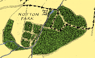 NOTTON PARK has an oval boundary on the Victorian map. This shape suggests an ancient wood rather than a later plantation. Most plantations have geometrical shapes since they were planted in a countryside already divided into holdings. The circular shape of some woods suggests that they were enclosed from a largely uncultivated landscape. A circular boundary is more economical to construct as it encloses the maximum area for the least expenditure in time and materials.
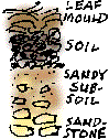
On a previous visit I dug a shallow soil profile to examine the structure of woodland soil in an area of planted Beeches. A layer of leaf mould covered an inch and a half of black soil. Beneath that, sandy subsoil, the product of weathering of the underlying rock, went down a further five inches. The deeper I dug the more fragments of rock I found.
|
 Since the Victorian period, a quarter of the wood, in the shape of an enormous pie wedge, has been cut out and is now farmed as arable.
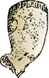
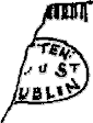 Keeper Lane, between the north east corner of Notton Park and the village, passes the site of a brick kiln. A few years ago I found this fragment of a clay pipe thrown up in excavations by the roadside.